What remains at the ends of the earth?
2022
Imani Jacqueline Brown
What remains at the ends of the earth?
2022
Soundscape by Andrea Catherine Steves and the artist.
Video, print
Installation views, 12th Berlin Biennale, Akademie der Künste, Hanseatenweg, 11.6.–18.9.2022, photo credit: dotgain.info
Commissioned by the 12th Berlin Biennale for Contemporary Art
Supported by VIA Art Fund & the Graham Foundation for Advanced Studies in the Fine Arts


Created on the occasion of the 12 Berlin Biennale with the support of VIA Art Fund and the Graham Foundation for Advanced Research in the Visual Arts. Flights courtesy of Healthy Gulf and South Wings.
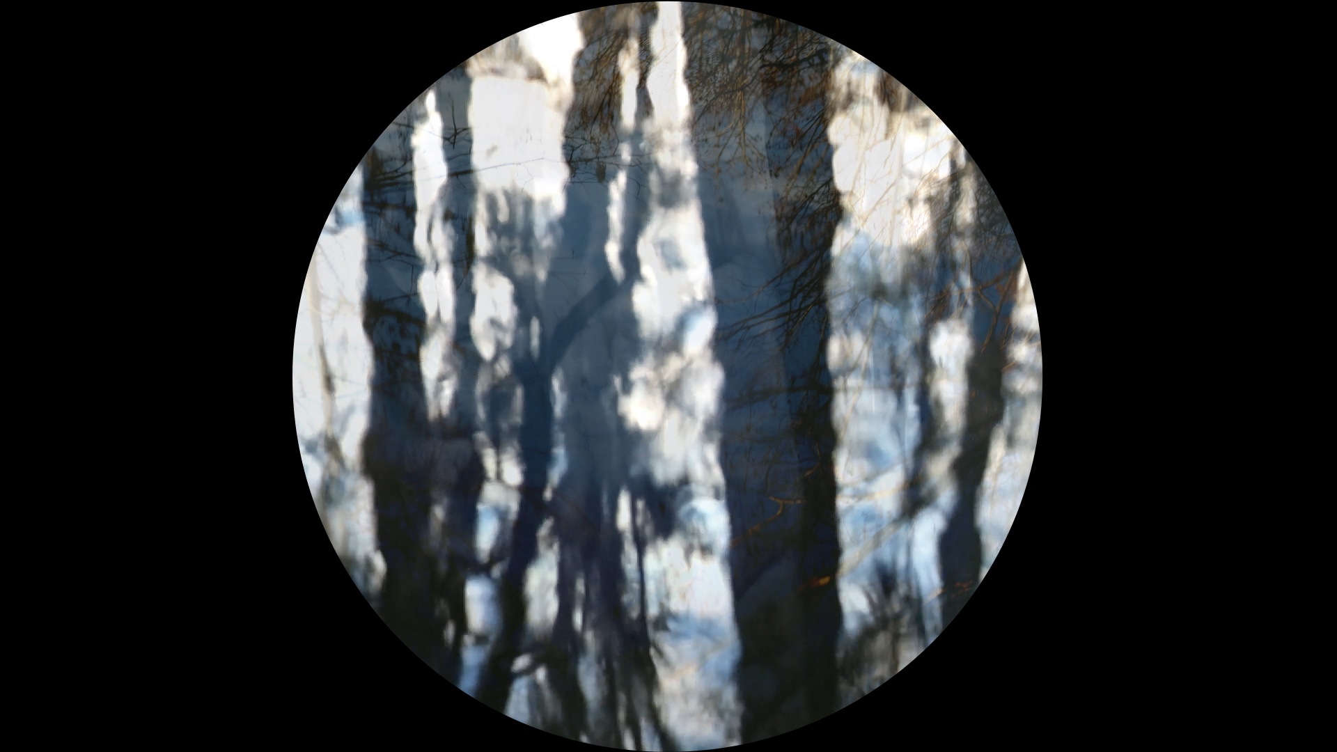
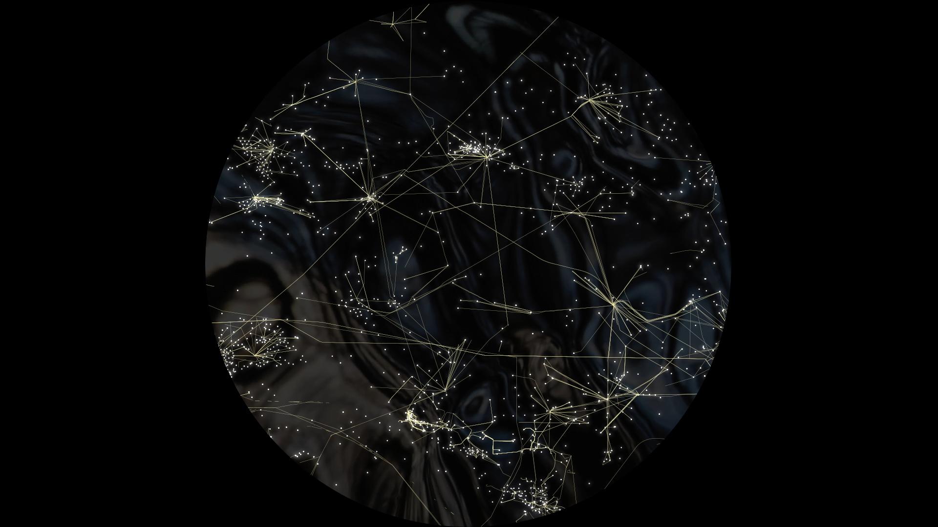
In this video animation, videography, photography, and sound were captured by the artist via canoe, foot, car, and three-passenger propeller plane in Louisiana's coastal wetlands. GIS lines and points representing pipelines, canals, and wells were sourced from the Louisiana Department of Natural Resources and animated by the artist. Satellite images were sourced from Google Earth. Maps were sourced from the US Public Land Survey System (PLSS) and date between 1830 and 1860. The PLSS was the first US system to plat (or divide) indigenous territory into private property.
This work is the outgrowth of a larger artist-activist research project into fossil fuel infrastructure in Louisiana’s coastal zone. Imani’s project Follow the Oil maps the fossil fuel production cycle from points of extraction to points of emissions, following the flow of oil through a single pipeline, and reveals the foundation of colonialism and slavery upon which the fossil fuel industry stands.
–––
In the coastal wetlands of the US state of Louisiana, the fossil fuel industry reigns as heir to the extractive logics and landscapes of settler colonialism and slavery. Oil and gas corporations have dredged 10,000 miles of canals to drill and access 90,000 wells, which connect through 50,000 miles of pipeline to over 200 plants in the ‘Petrochemical Corridor’. This invasive infrastructure severs the integrity of Louisiana’s more-than-human ecologies. Canals kill the vegetation that holds sediment together as land; since the 1930s, 2,000 square miles of wetlands have disintegrated into the sea.
This place is known by many names: Named for the corset of slave plantations that strangle the Mississippi River, it is known as “Plantation Country”. Infamous for producing the most toxic air in the US, it is known as “Cancer Alley”. Residents knew the region first as ‘home’. And once it was part of a region known by two dozen indigenous nations as ‘Bulbancha’, meaning land of many languages. For how much longer will this land be known?
And still, while this land holds the accumulations of 300 years of extractive violence, it also supports its repair. Historically enslaved people planted magnolia and willow trees to mark the graves of their loved ones, retaining a pan-African tradition. Today, their carefully cultivated microecologies conspire with Black activists to resist the continuum of extractivism to the ends of the earth and beyond.
Playlist produced for the exhibition Dear Earth: Art and Hope in a Time of Crisis at Hayward Gallery, London, UK.